Skip to content

+65 6703 6930 | [email protected]

GeoInstinct LogoGeoInstinct LogoGeoInstinct Logo
  • Company
    • About
    • Meet the Team
    • Our Equipment
    • Our Software
    • Our Partners
  • Services
    • Assets
      • Asset Tagging
    • Geodetic
      • Control Networks
      • Construction Survey & Setting Out
      • Construction Verification
      • Floor Flatness Surveys
      • Measured Building Surveys
      • Topographical Surveys
      • Stockpile & Volume Surveys
    • Geophysical
      • Gravity Surveys
      • Magnetic Surveys
      • Soil Resistivity Testing
    • Geotechnical
    • Hydrographic
    • Inspection
      • Concrete & Rebar Scanning
      • Wind Turbine Inspection
    • Mapping
      • Airborne Survey
      • Mobile Mapping
      • Underground Utility Mapping
    • Metrology
      • Alignment & Levelling Services
      • Deformation & Surface Analysis
      • Laser Tracker Measurements
      • Measurement Arm Services
      • Reverse Engineering Services
    • Monitoring
      • Environmental Monitoring
      • Geotechnical Monitoring
      • Structural Monitoring
    • Reality Capture
      • BWTS Scanning
      • Laser Scanning
      • Scan-to-BIM
      • Scan-to-EAM
      • Scan-to-Plan
    • Specialist
      • Gyroscopic Surveys
      • Rail Surveys
    • Utilities
      • CCTV Drainage Surveys
      • Ground Penetrating Radar Surveys
      • Line and Level Surveys
      • Manhole Surveys
  • Consultancy
    Digital Consultancy
    • Digital Surveying and Reality Capture
    • Digital Twins
    • Geospatial Information Management
    • Industry 4.0
    • Smart Asset Management
    • Smart Cities
    • Smart Enterprise Management
    • Smart Facilities Management
    Strategic Consultancy
    • BIM Education and Training
    • BIM Strategy, Performance, Protocols and Procedures
    • Compliance and Assurance
    • Construction Forensics
    • Industrial Cyber Security
    • Management Consulting
    • Organisational Digital Transformation
    • Whole Lifecycle Project Management
    Virtual Design & Construction
    • Artificial Intelligence and Machine Learning
    • As-Built Construction Verification
    • Augmented Worker
    • Automated BIM Verification and Validation
    • Design for Off-Site Manufacture and Assembly
    • Enterprise Management Dashboards
    • Integrated Project Information Management
    • Predictive Scenario Modelling
    • Virtual, Augmented and Mixed Reality
    • Digital Consultancy
      • Digital Surveying and Reality Capture
      • Digital Twins
      • Geospatial Information Management
      • Industry 4.0
      • Smart Asset Management
      • Smart Cities
      • Smart Enterprise Management
      • Smart Facilities Management
    • Engineering Consultancy
    • Strategic Consultancy
      • BIM Education and Training
      • BIM Strategy, Performance, Protocols and Procedures
      • Compliance and Assurance
      • Construction Forensics
      • Industrial Cyber Security
      • Management Consulting
      • Organisational Digital Transformation
      • Whole Lifecycle Project Management
    • Virtual Design and Construction
      • Artificial Intelligence and Machine Learning
      • As-Built Construction Verification
      • Augmented Worker
      • Automated BIM Verification and Validation
      • Design for Off-Site Manufacture and Assembly
      • Enterprise Management Dashboards
      • Integrated Project Information Management
      • Predictive Scenario Modelling
      • Virtual, Augmented and Mixed Reality
  • News
Home » コンサルティング » バーチャル設計・施工 » 自動化されたBIMの検証・妥当性確認

自動化されたBIMの検証・妥当性確認

GeoInstinctは、各プロジェクトを成功させるために、成果物のチェック、品質の測定、確立された要件や標準への準拠の検証をサポートします。

自動化されたBIMの検証・妥当性確認Webmaster2023-05-07T18:26:59+07:00
  • Technology
  • Benefits
  • Bridge to BIM

どのように検証するのか?

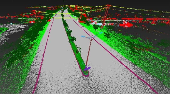
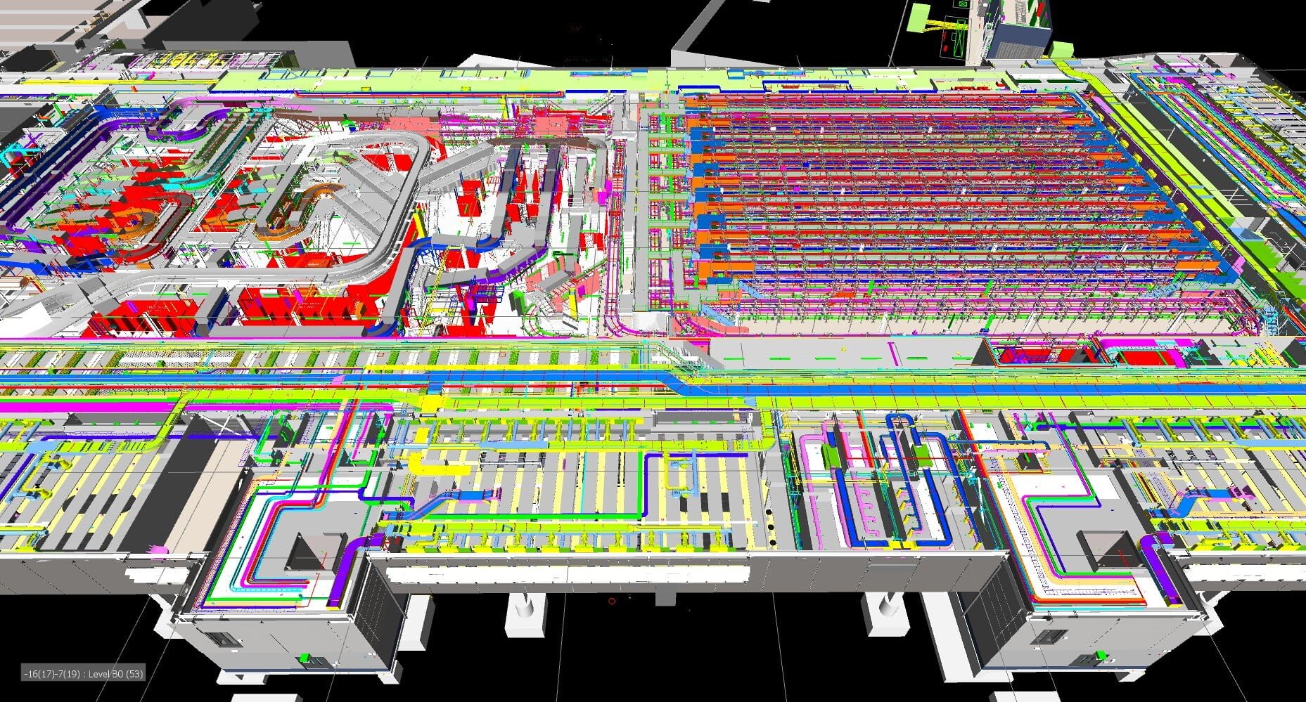
GeoInstinctは、市場をリードするソフトウェアとテクノロジーを使用しており、モデルの自動検証やバリデーションを可能にし、設計段階から継続的にモデルをチェックすることで、人的エラーを排除し、クライアントの時間とコストの削減を実現します。
何を可能にするのか?

市場をリードするソフトウェアと技術により、プロジェクトの設計段階から建設設計モデルを自動的にチェック・分析することができ、これにより以下のことが可能になります:

  • 高度な衝突検出を行い、関連する問題を迅速かつ容易に特定し修正する。
  • 建設段階が始まる前に、潜在的な欠陥や不足を発見する
  • モデルから欠落している部品や材料を検索し、欠陥を検出する。
  • BIMとアクセシビリティのコンプライアンスを確保する
  • 同じモデルの2つのデザインバージョン間で、モデルを比較し、変更を追跡する。
  • 変更指示の管理
  • モデルチェンジの可視化と検証を容易にし、時間を節約します。

BIMへの架け橋

私たちが使用するソフトウェアは、幾何学的にモデリングされたものの品質を測定するだけでなく、各モデルオブジェクトに付随するデータの品質を測定することで、資産のライフサイクル全体に役立つBIMモデルを提供することができます。

また、設計・審査(計画、法規制への対応)、設計・施工(施工前のチェックでモデルの品質と整合性を確保)、施工・運用(空間とそれに伴う要件や動作の定義)など、プロジェクトのライフサイクルの異なるフェーズ間の橋渡しをすることができ、お客様に多くの利益をもたらしています。
Contact Us

Call Us

+84 (0) 28 710 99 369

Email Us

[email protected]

Client Hub

  • GeoInstinct Access
  • GeoInstinct Assist
  • GeoInstinct Books
  • GeoInstinct Cloud
  • GeoInstinct Cyclone
  • GeoInstinct Projects
  • GeoInstinct Status
  • GeoInstinct Support

About Us

  • About
  • Our Equipment
  • Our Software
  • Our Partners
  • Events
  • News
  • Meet the Team
  • Careers

Legal

  • Privacy Policy
  • Terms & Conditions
  • Service Commitment

Vietnam

GeoInstinct Vietnam Co. Ltd.

MST: 0314818251

11A Dong Da, Ward 2, Tan Binh District, Ho Chi Minh City, Vietnam, 700000

Singapore

GeoInstinct Pte. Ltd.

UDN: 202328899R

68 Circular Road, #02-01, Singapore, 049422

Copyright © 2023, GeoInstinct Pty Ltd. All Rights Reserved.

Toggle Sliding Bar Area
Page load link
Go to Top