Skip to content

+65 6703 6930 | [email protected]

GeoInstinct LogoGeoInstinct LogoGeoInstinct Logo
  • Company
    • About
    • Meet the Team
    • Our Equipment
    • Our Software
    • Our Partners
  • Services
    • Assets
      • Asset Tagging
    • Geodetic
      • Control Networks
      • Construction Survey & Setting Out
      • Construction Verification
      • Floor Flatness Surveys
      • Measured Building Surveys
      • Topographical Surveys
      • Stockpile & Volume Surveys
    • Geophysical
      • Gravity Surveys
      • Magnetic Surveys
      • Soil Resistivity Testing
    • Geotechnical
    • Hydrographic
    • Inspection
      • Concrete & Rebar Scanning
      • Wind Turbine Inspection
    • Mapping
      • Airborne Survey
      • Mobile Mapping
      • Underground Utility Mapping
    • Metrology
      • Alignment & Levelling Services
      • Deformation & Surface Analysis
      • Laser Tracker Measurements
      • Measurement Arm Services
      • Reverse Engineering Services
    • Monitoring
      • Environmental Monitoring
      • Geotechnical Monitoring
      • Structural Monitoring
    • Reality Capture
      • BWTS Scanning
      • Laser Scanning
      • Scan-to-BIM
      • Scan-to-EAM
      • Scan-to-Plan
    • Specialist
      • Gyroscopic Surveys
      • Rail Surveys
    • Utilities
      • CCTV Drainage Surveys
      • Ground Penetrating Radar Surveys
      • Line and Level Surveys
      • Manhole Surveys
  • Consultancy
    Digital Consultancy
    • Digital Surveying and Reality Capture
    • Digital Twins
    • Geospatial Information Management
    • Industry 4.0
    • Smart Asset Management
    • Smart Cities
    • Smart Enterprise Management
    • Smart Facilities Management
    Strategic Consultancy
    • BIM Education and Training
    • BIM Strategy, Performance, Protocols and Procedures
    • Compliance and Assurance
    • Construction Forensics
    • Industrial Cyber Security
    • Management Consulting
    • Organisational Digital Transformation
    • Whole Lifecycle Project Management
    Virtual Design & Construction
    • Artificial Intelligence and Machine Learning
    • As-Built Construction Verification
    • Augmented Worker
    • Automated BIM Verification and Validation
    • Design for Off-Site Manufacture and Assembly
    • Enterprise Management Dashboards
    • Integrated Project Information Management
    • Predictive Scenario Modelling
    • Virtual, Augmented and Mixed Reality
    • Digital Consultancy
      • Digital Surveying and Reality Capture
      • Digital Twins
      • Geospatial Information Management
      • Industry 4.0
      • Smart Asset Management
      • Smart Cities
      • Smart Enterprise Management
      • Smart Facilities Management
    • Engineering Consultancy
    • Strategic Consultancy
      • BIM Education and Training
      • BIM Strategy, Performance, Protocols and Procedures
      • Compliance and Assurance
      • Construction Forensics
      • Industrial Cyber Security
      • Management Consulting
      • Organisational Digital Transformation
      • Whole Lifecycle Project Management
    • Virtual Design and Construction
      • Artificial Intelligence and Machine Learning
      • As-Built Construction Verification
      • Augmented Worker
      • Automated BIM Verification and Validation
      • Design for Off-Site Manufacture and Assembly
      • Enterprise Management Dashboards
      • Integrated Project Information Management
      • Predictive Scenario Modelling
      • Virtual, Augmented and Mixed Reality
  • News
Home » الاستشارات » التصميم والبناء الافتراضي » نمذجة السيناريو التنبؤية

نمذجة السيناريو التنبؤية

تدعم GeoInstinct العملاء لتنفيذ نمذجة السيناريو التنبؤية على المشاريع لفهم الخيارات والاختلافات المحتملة بشكل كامل لتخطيط البناء وتسلسل المشروع.

نمذجة السيناريو التنبؤيةWebmaster2023-05-07T23:18:15+07:00
  • Augmenting BIM
  • Technology
  • Approach
  • Benefits

زيادة 4D BIM

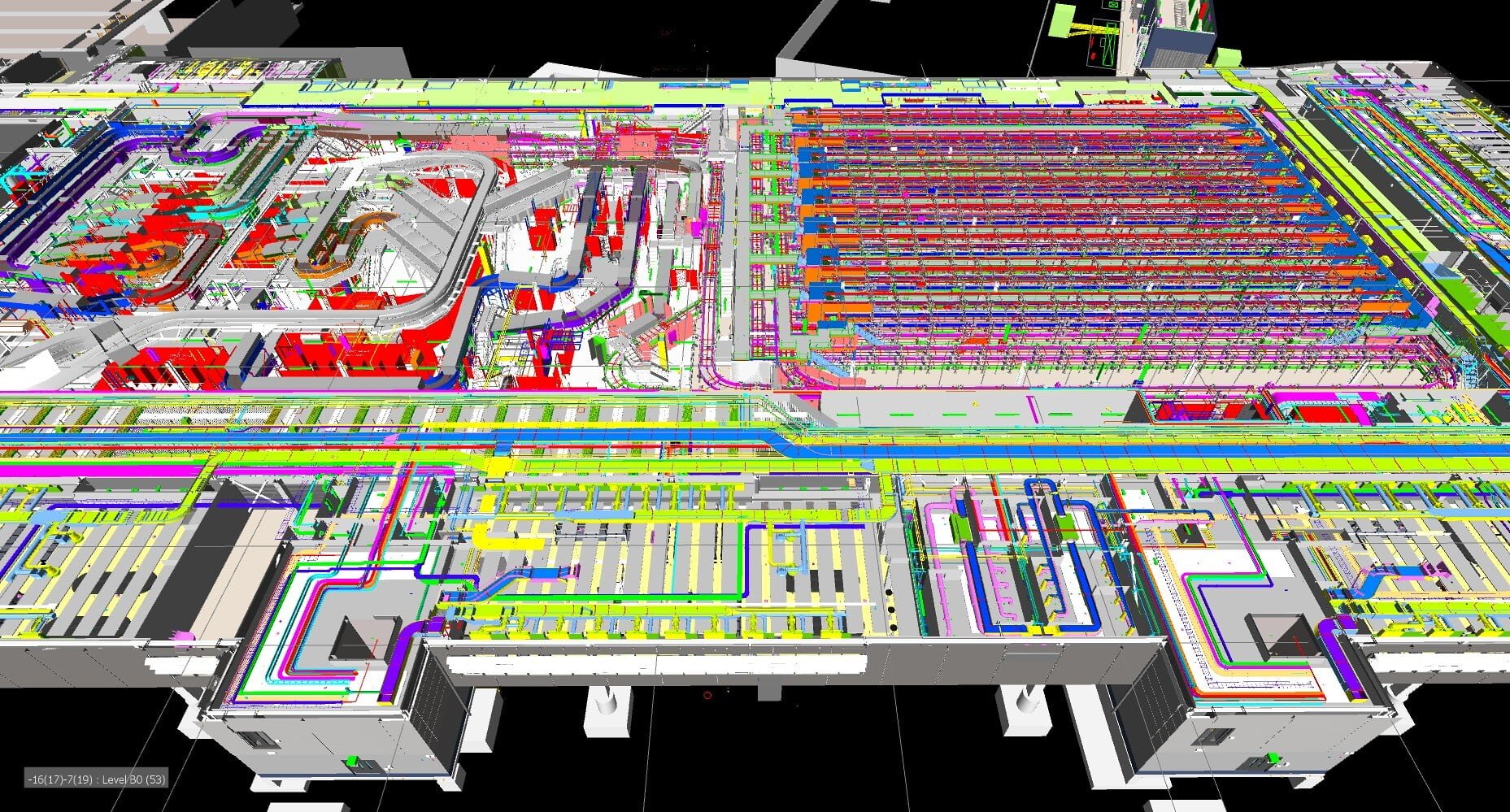
عندما يتم إنشاء نموذج معلومات للأصل ، يمكن إضافة بيانات جدولة أنشطة برنامج البناء إلى المكونات ، مما يؤدي إلى إنشاء محاذاة دقيقة لمعلومات البرنامج ، مما يتيح مراجعة مرئية خطوة بخطوة لتطوير المشروع. تُعرف هذه العملية باسم “4D BIM” ، وهي تلخص نمذجة السيناريو التنبئي كجزء من هذا.

يتيح استخدامنا لنمذجة السيناريو التنبئي لنا ولعملائنا الفهم الكامل للخيارات والاختلافات المحتملة لتخطيط البناء وتسلسل المشروع. قد تنشأ هذه من مشاكل في الموقع ، والتأخير وفقدان معالم المشروع.
تكنولوجيا

يتيح تضمين بيانات السمات المتعلقة بالوقت أيضًا إنشاء مرئيات ثلاثية الأبعاد لتطوير المشروع ، مما يوضح كيفية إنشائه وكيف سيظهر كل من الهيكل والموقع المحيط في كل مرحلة. هذا مفيد للغاية من حيث تخطيط العمل بطريقة آمنة ومنطقية تزيد من الكفاءة في الموقع.

من خلال تقديم معلومات عن البرامج والمعلومات المرئية مثل هذه ، يمكن لخبرائنا وضع نماذج أولية فعالة للأصول في بيئة افتراضية أولاً وتقديم ملاحظات سريعة حول تغييرات التصميم أو المنهجية للأعضاء الآخرين في فريق المشروع.

يقترب

يمكّن هذا النهج GeoInstinct من تقليل أعمال تنسيق التصميم في الموقع في اللحظة الأخيرة والتخلص من النفايات من عملية التسليم. يمكن أن تؤدي الكفاءة التي تم إنشاؤها إلى تبسيط تكلفة فرق المشروع وزيادة قدرتها ، مع تقليل تكاليف التسليم الإجمالية للعملاء.

تعد نمذجة السيناريو التنبئي أيضًا أداة قوية لتوصيل مراحل وتأثير الأصل المبني مع أصحاب المصلحة المحليين أثناء التسليم وبمجرد الانتهاء ، مما يعزز مشاركة أصحاب المصلحة من مفهوم المشروع حتى الانتهاء.
فوائد

تجلب نمذجة السيناريو التنبئي العديد من الفوائد ، بما في ذلك:

  • ثراء التفاعل مع أصحاب المصلحة
  • تحسين مشاركة أصحاب المصلحة
  • رؤية محسّنة ووضوح للتخطيط
  • المزيد من اجتماعات البرنامج الاستباقية والمشاركة
  • تقييم أكثر فعالية وسرعة لبدائل خيارات البرنامج
  • يتم تخطيط العمل بطريقة آمنة ومنطقية تزيد من الكفاءة في الموقع
  • تعزيز البناء والتنسيق
  • يمكن فحص تسلسل البناء كسلسلة من المشاكل التي تمكن المستخدمين من استكشاف الخيارات وإدارة الحلول وتحسين النتائج
  • تمكن من تطوير منتجات البناء
  • تنفيذ مشروع تعاوني
  • يمكن إجراء قياسات مختلفة بين الجداول الزمنية “المبنية” والجداول المخططة من أجل تحسين الإدارة العامة خلال دورة حياة المشروع بأكملها
  • يُمكِّن من تصوير تسلسل الأحداث بشكل مرئي على مخطط زمني يسهل فهمه

Contact Us

Call Us

+84 (0) 28 710 99 369

Email Us

[email protected]

Client Hub

  • GeoInstinct Access
  • GeoInstinct Assist
  • GeoInstinct Books
  • GeoInstinct Cloud
  • GeoInstinct Cyclone
  • GeoInstinct Projects
  • GeoInstinct Status
  • GeoInstinct Support

About Us

  • About
  • Our Equipment
  • Our Software
  • Our Partners
  • Events
  • News
  • Meet the Team
  • Careers

Legal

  • Privacy Policy
  • Terms & Conditions
  • Service Commitment

Vietnam

GeoInstinct Vietnam Co. Ltd.

MST: 0314818251

11A Dong Da, Ward 2, Tan Binh District, Ho Chi Minh City, Vietnam, 700000

Singapore

GeoInstinct Pte. Ltd.

UDN: 202328899R

68 Circular Road, #02-01, Singapore, 049422

Copyright © 2023, GeoInstinct Pty Ltd. All Rights Reserved.

Toggle Sliding Bar Area
Page load link
Go to Top