Skip to content

+65 6703 6930 | [email protected]

GeoInstinct LogoGeoInstinct LogoGeoInstinct Logo
  • Company
    • About
    • Meet the Team
    • Our Equipment
    • Our Software
    • Our Partners
  • Services
    • Assets
      • Asset Tagging
    • Geodetic
      • Control Networks
      • Construction Survey & Setting Out
      • Construction Verification
      • Floor Flatness Surveys
      • Measured Building Surveys
      • Topographical Surveys
      • Stockpile & Volume Surveys
    • Geophysical
      • Gravity Surveys
      • Magnetic Surveys
      • Soil Resistivity Testing
    • Geotechnical
    • Hydrographic
    • Inspection
      • Concrete & Rebar Scanning
      • Wind Turbine Inspection
    • Mapping
      • Airborne Survey
      • Mobile Mapping
      • Underground Utility Mapping
    • Metrology
      • Alignment & Levelling Services
      • Deformation & Surface Analysis
      • Laser Tracker Measurements
      • Measurement Arm Services
      • Reverse Engineering Services
    • Monitoring
      • Environmental Monitoring
      • Geotechnical Monitoring
      • Structural Monitoring
    • Reality Capture
      • BWTS Scanning
      • Laser Scanning
      • Scan-to-BIM
      • Scan-to-EAM
      • Scan-to-Plan
    • Specialist
      • Gyroscopic Surveys
      • Rail Surveys
    • Utilities
      • CCTV Drainage Surveys
      • Ground Penetrating Radar Surveys
      • Line and Level Surveys
      • Manhole Surveys
  • Consultancy
    Digital Consultancy
    • Digital Surveying and Reality Capture
    • Digital Twins
    • Geospatial Information Management
    • Industry 4.0
    • Smart Asset Management
    • Smart Cities
    • Smart Enterprise Management
    • Smart Facilities Management
    Strategic Consultancy
    • BIM Education and Training
    • BIM Strategy, Performance, Protocols and Procedures
    • Compliance and Assurance
    • Construction Forensics
    • Industrial Cyber Security
    • Management Consulting
    • Organisational Digital Transformation
    • Whole Lifecycle Project Management
    Virtual Design & Construction
    • Artificial Intelligence and Machine Learning
    • As-Built Construction Verification
    • Augmented Worker
    • Automated BIM Verification and Validation
    • Design for Off-Site Manufacture and Assembly
    • Enterprise Management Dashboards
    • Integrated Project Information Management
    • Predictive Scenario Modelling
    • Virtual, Augmented and Mixed Reality
    • Digital Consultancy
      • Digital Surveying and Reality Capture
      • Digital Twins
      • Geospatial Information Management
      • Industry 4.0
      • Smart Asset Management
      • Smart Cities
      • Smart Enterprise Management
      • Smart Facilities Management
    • Engineering Consultancy
    • Strategic Consultancy
      • BIM Education and Training
      • BIM Strategy, Performance, Protocols and Procedures
      • Compliance and Assurance
      • Construction Forensics
      • Industrial Cyber Security
      • Management Consulting
      • Organisational Digital Transformation
      • Whole Lifecycle Project Management
    • Virtual Design and Construction
      • Artificial Intelligence and Machine Learning
      • As-Built Construction Verification
      • Augmented Worker
      • Automated BIM Verification and Validation
      • Design for Off-Site Manufacture and Assembly
      • Enterprise Management Dashboards
      • Integrated Project Information Management
      • Predictive Scenario Modelling
      • Virtual, Augmented and Mixed Reality
  • News
Home » 가상 설계 및 시공 » 통합 프로젝트 정보 관리

통합 프로젝트 정보 관리

GeoInstinct는 고객이 기존 방법을 방해하는 고유한 문제를 시각화, 분석 및 해결할 수 있도록 지원합니다. 당사의 솔루션은 실시간 엔지니어링 데이터의 동적 분석에 중점을 두어 구조화되지 않은 데이터의 자동화를 가능하게 합니다.

통합 프로젝트 정보 관리Webmaster2023-05-07T18:27:05+07:00
  • Risk Management
  • Solution
  • Benefits

위기 관리

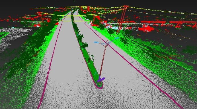
건설 및 설치 활동과 관련된 위험은 프로젝트 프로그램 및 계획에 상당한 문제를 야기합니다. 현재 시퀀싱 솔루션은 이상적인 시나리오를 기반으로 하지만 프로그램의 변형을 처리하고 문제가 발생할 때 대응하고 해결하기 위한 확고한 프로세스나 솔루션이 없습니다.

순차적 활동의 상세한 분석을 지원하기 위해 데이터 소스를 집계하는 기능과 다른 활동으로 인한 제약 조건 및 영향을 시각화하는 기능을 통해 프로젝트 활동에 대한 강력하고 예측 가능한 통찰력을 제공합니다.
해결책

당사의 솔루션은 기존 방법을 방해하는 고유한 문제를 시각화, 분석 및 해결하기 위해 개발되었습니다.

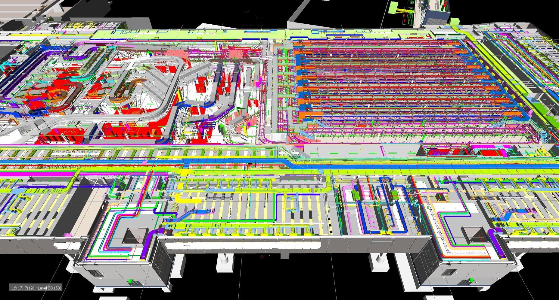
당사의 솔루션은 실시간 엔지니어링 데이터의 동적 분석에 중점을 두어 구조화되지 않은 데이터의 자동화를 가능하게 합니다. 여기에서 다양한 데이터 소스를 집계하여 잠재적인 문제가 중요해지기 오래 전에 가시적으로 제공할 수 있습니다. 현재 방법은 지연과 영향이 발생할 때만 인식하므로 이는 솔루션 성공의 중요한 측면입니다.

예측 결과는 이벤트가 발생하기 전에 관리, 완화 및 감소를 가능하게 합니다. 실행 가능한 백로그의 Last Planner 개념을 구현할 수 있으므로 계약자는 계획된 활동에서 발생하는 문제에 대응하여 다른 영역으로 노력을 옮길 수 있습니다.

이익

구조화된 데이터를 단일 프로젝트 정보 관리 도구에 통합하여 기존 도구의 제한을 완화하면 다음과 같은 이점을 활용할 수 있습니다.

  • 문제, 위험 및 핫스팟 시각화 및 식별
  • 3D에서 사용 가능한 출력 생성
  • 접근, 배치 및 임시 작업 활동 관리
  • 기존 데이터를 구조화 및 집계하여 상호 운용성 향상
  • 물류 활동을 동적으로 분석
  • 계획되지 않은 변경에 대한 옵션 및 대응
  • 물류 및 임시 작업 오버레이

Contact Us

Call Us

+84 (0) 28 710 99 369

Email Us

[email protected]

Client Hub

  • GeoInstinct Access
  • GeoInstinct Assist
  • GeoInstinct Books
  • GeoInstinct Cloud
  • GeoInstinct Cyclone
  • GeoInstinct Projects
  • GeoInstinct Status
  • GeoInstinct Support

About Us

  • About
  • Our Equipment
  • Our Software
  • Our Partners
  • Events
  • News
  • Meet the Team
  • Careers

Legal

  • Privacy Policy
  • Terms & Conditions
  • Service Commitment

Vietnam

GeoInstinct Vietnam Co. Ltd.

MST: 0314818251

11A Dong Da, Ward 2, Tan Binh District, Ho Chi Minh City, Vietnam, 700000

Singapore

GeoInstinct Pte. Ltd.

UDN: 202328899R

68 Circular Road, #02-01, Singapore, 049422

Copyright © 2023, GeoInstinct Pty Ltd. All Rights Reserved.

Toggle Sliding Bar Area
Page load link
Go to Top