Skip to content

+65 6703 6930 | [email protected]

GeoInstinct LogoGeoInstinct LogoGeoInstinct Logo
  • Company
    • About
    • Meet the Team
    • Our Equipment
    • Our Software
    • Our Partners
  • Services
    • Assets
      • Asset Tagging
    • Geodetic
      • Control Networks
      • Construction Survey & Setting Out
      • Construction Verification
      • Floor Flatness Surveys
      • Measured Building Surveys
      • Topographical Surveys
      • Stockpile & Volume Surveys
    • Geophysical
      • Gravity Surveys
      • Magnetic Surveys
      • Soil Resistivity Testing
    • Geotechnical
    • Hydrographic
    • Inspection
      • Concrete & Rebar Scanning
      • Wind Turbine Inspection
    • Mapping
      • Airborne Survey
      • Mobile Mapping
      • Underground Utility Mapping
    • Metrology
      • Alignment & Levelling Services
      • Deformation & Surface Analysis
      • Laser Tracker Measurements
      • Measurement Arm Services
      • Reverse Engineering Services
    • Monitoring
      • Environmental Monitoring
      • Geotechnical Monitoring
      • Structural Monitoring
    • Reality Capture
      • BWTS Scanning
      • Laser Scanning
      • Scan-to-BIM
      • Scan-to-EAM
      • Scan-to-Plan
    • Specialist
      • Gyroscopic Surveys
      • Rail Surveys
    • Utilities
      • CCTV Drainage Surveys
      • Ground Penetrating Radar Surveys
      • Line and Level Surveys
      • Manhole Surveys
  • Consultancy
    Digital Consultancy
    • Digital Surveying and Reality Capture
    • Digital Twins
    • Geospatial Information Management
    • Industry 4.0
    • Smart Asset Management
    • Smart Cities
    • Smart Enterprise Management
    • Smart Facilities Management
    Strategic Consultancy
    • BIM Education and Training
    • BIM Strategy, Performance, Protocols and Procedures
    • Compliance and Assurance
    • Construction Forensics
    • Industrial Cyber Security
    • Management Consulting
    • Organisational Digital Transformation
    • Whole Lifecycle Project Management
    Virtual Design & Construction
    • Artificial Intelligence and Machine Learning
    • As-Built Construction Verification
    • Augmented Worker
    • Automated BIM Verification and Validation
    • Design for Off-Site Manufacture and Assembly
    • Enterprise Management Dashboards
    • Integrated Project Information Management
    • Predictive Scenario Modelling
    • Virtual, Augmented and Mixed Reality
    • Digital Consultancy
      • Digital Surveying and Reality Capture
      • Digital Twins
      • Geospatial Information Management
      • Industry 4.0
      • Smart Asset Management
      • Smart Cities
      • Smart Enterprise Management
      • Smart Facilities Management
    • Engineering Consultancy
    • Strategic Consultancy
      • BIM Education and Training
      • BIM Strategy, Performance, Protocols and Procedures
      • Compliance and Assurance
      • Construction Forensics
      • Industrial Cyber Security
      • Management Consulting
      • Organisational Digital Transformation
      • Whole Lifecycle Project Management
    • Virtual Design and Construction
      • Artificial Intelligence and Machine Learning
      • As-Built Construction Verification
      • Augmented Worker
      • Automated BIM Verification and Validation
      • Design for Off-Site Manufacture and Assembly
      • Enterprise Management Dashboards
      • Integrated Project Information Management
      • Predictive Scenario Modelling
      • Virtual, Augmented and Mixed Reality
  • News
Home » 가상 설계 및 시공 » 가상, 증강 및 혼합 현실

가상, 증강 및 혼합 현실

GeoInstinct는 이러한 몰입형 경험이 제공하는 이점을 활용하기 위해 가상 및 증강 현실을 수용하여 풍부한 모델을 제공하고 몰입형 리뷰의 일부로 디자인 기반 수정을 실시간으로 수행할 수 있도록 합니다.

가상, 증강 및 혼합 현실Webmaster2023-05-07T18:27:20+07:00
  • Solution
  • Technology
  • Benefits

해결책

GeoInstinct의 솔루션은 몰입형 리뷰의 일부로 모델 및 디자인 기반 수정을 실시간으로 수행할 수 있는 이러한 몰입형 경험이 제공하는 이점을 활용합니다.

이것은 프로젝트 모델 워크플로를 최적화하고 디지털 데이터의 이중 처리를 제거하고 의사 결정 및 설계 수정을 한 단계 끌어올리는 데 핵심입니다.

특히 가상 현실 기술을 사용하여 설계 및 구축 프로세스 전반에 걸쳐 활용할 수 있는 실제와 같은 디지털 트윈 모델에 몰입할 수 있는 기회를 고객에게 제공할 수 있습니다.
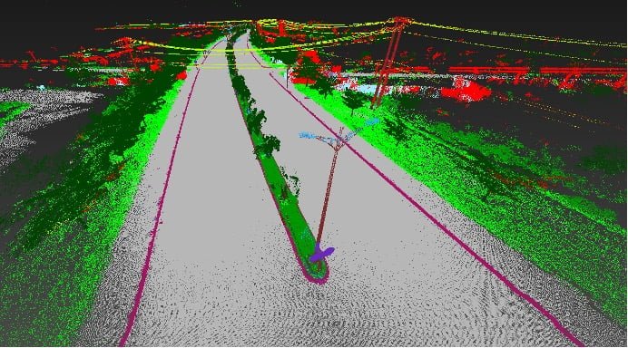
가상 현실(VR)

가상 현실(VR)은 사람이 탐색하고 상호 작용할 수 있는 3차원 컴퓨터 생성 환경을 설명하는 데 사용되는 용어입니다. 그 사람은 이 가상 세계의 일부가 되거나 이 환경에 몰입되어 물체를 조작하거나 일련의 작업을 수행할 수 있습니다.

증강 현실(AR)

증강 현실(Augmented Reality, AR)은 소리, 비디오 또는 그래픽과 같은 컴퓨터 생성 감각 입력에 의해 증강되는 물리적 실제 환경의 실시간 직접 보기입니다. AR은 현실 세계에 고정되거나 그 일부가 아닌 실제 세계의 데이터 오버레이에 가깝습니다. 실제 콘텐츠와 컴퓨터 생성 콘텐츠는 서로 대응할 수 없습니다.

혼합 현실(MR)

혼합 현실(Mixed Reality, MR)은 실제 세계와 가상 세계를 병합하여 물리적 개체와 디지털 개체가 실시간으로 공존하고 상호 작용하는 새로운 환경과 시각화를 생성합니다. MR을 우리 환경의 물리적 데이터에 고정되고 상호 작용하는 실제 세계의 합성 콘텐츠 오버레이로 생각하십시오.
기술

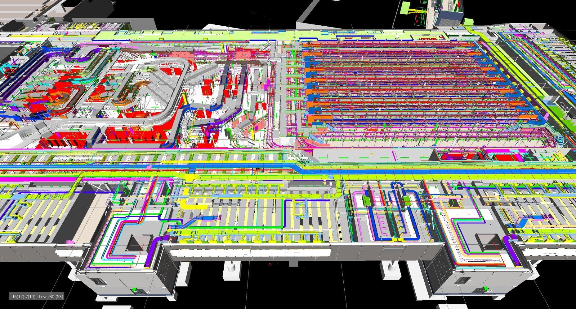
당사의 전문 소프트웨어를 사용하여 BIM 모델을 가상 현실 경험에 완벽하게 통합하여 고객이 자산이 어떻게 보이는지 실제로 엿볼 수 있고 기존 모니터에서는 달성할 수 없는 규모와 설계 타당성을 이해할 수 있습니다.

그런 다음 이러한 모델의 정보를 증강 현실로 가져올 수 있으므로 현장의 계약자가 중요한 모델 정보에 빠르게 액세스할 수 있습니다. 증강 현실은 또한 보다 개방적인 설계 검토를 위해 사무실 내에서 협업 방식을 제공하므로 엔지니어가 동일한 홀로그램 모델을 보고 협업할 수 있습니다.

Contact Us

Call Us

+84 (0) 28 710 99 369

Email Us

[email protected]

Client Hub

  • GeoInstinct Access
  • GeoInstinct Assist
  • GeoInstinct Books
  • GeoInstinct Cloud
  • GeoInstinct Cyclone
  • GeoInstinct Projects
  • GeoInstinct Status
  • GeoInstinct Support

About Us

  • About
  • Our Equipment
  • Our Software
  • Our Partners
  • Events
  • News
  • Meet the Team
  • Careers

Legal

  • Privacy Policy
  • Terms & Conditions
  • Service Commitment

Vietnam

GeoInstinct Vietnam Co. Ltd.

MST: 0314818251

11A Dong Da, Ward 2, Tan Binh District, Ho Chi Minh City, Vietnam, 700000

Singapore

GeoInstinct Pte. Ltd.

UDN: 202328899R

68 Circular Road, #02-01, Singapore, 049422

Copyright © 2023, GeoInstinct Pty Ltd. All Rights Reserved.

Toggle Sliding Bar Area
Page load link
Go to Top